Lore:Narthendar (region)
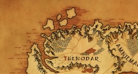
The Narthendar region is one of several that make up the Althas continent. This region is the home of the Thenodrim (once known as the Narthendi) and contains the kingdom of Thenodar (formerly the kingdom of Narthendar).
The meaning for the word Narthendar is unknown, as it comes from the now extinct Celestial language.
Contents
History
[WIP]
Geography
Thenodar is divided into four two major subregions:
- Hláfland ("High Land" in Old Maelan) makes up the North East
- Nitherland ("Low Land" in Old Maelan) makes up the South East
- Fennland ("Mire Land" in Old Maelan) makes up the South West
- Útland ("Out Land" in Old Maelan) makes up the North West
A ridge divides the land in half.
- West of Narthendar is the Lamniemalos region, which is divided by the Westweall Mountains ("West Wall" in Old Mealen), and as the Vishevall Mountains ("West Wall" in Noralar).
- South of Narthendar is the Driesefair region, which is divided by the Zecrovam Mountains ("High Crown" in Noralar)
Fennland
The South West's topography is mostly made up of bogland. Few enter the land south of Èarýung (and west of Arísan).
Landmarks
- Hreámór: The boglands which make up most of Fennland. Hreámór means "crying moor" in Old Maelan, and was named for those who have become lost in the large swmapland.
Rivers
- Èamirra: River that goes into the mires of Fennland. Èamirra means "deceiver river" in Old Maelan, and was named because it was considered a treacherous river that few should enter.
Hláfland & Útland
The north's border acts as a large plateau. The northern uplands are very hilly and craggy (as are the north mountains) in both Hláfland and Útland. The center is fairly level and barren, a subtundra with tundra around the feet of the northern mountains. The upland hills are fairly craggy as are the northern mountains.
Landmarks
- Faesholt: Forest in northeastern Narthendar. Faesholt means "fringe forest" in Old Maelan.
- Haelscíma: The tallest mountain peak in all of Althas, located in northern Narthendar. The Thenodrim believe this location to be the place of their origin. Within the mountain can be found the ruins of Thovairozil, and beneath that the halls of Zalothairar. Haelscíma means "Shadow of Omen" in Old Maelan. In Noralar it is known as Voshellas, which means "World Pillar".
- Wídholt: Forest in northwestern Narthendar. Wídholt means "wide forest" in Old Maelan.
Rivers
- Èacamb: River north of Widholt. Èacamb means "crest river" in Old Maelan.
- Èarýung: River east of Widholt. Èarýung means "roaring river" in Old Maelan, and was named due to the strong current of the river.
- Èathegn: River west of Faesholt. Èathegn means "servant river" in Old Maelan, and was named by North Narthendar as it acted as a "servant" to the city of Randell.
- Èathéowe: River east of Faesholt. Èathéowe means "handmaiden river" in Old Maelan, and was named by North Narthendar as it acted as a "sister" river to Èathegn.
- Èawita: The River that goes through Widholt. Èawita means "wise man river" in Old Maelan, and was named because it was considered a river that offered sage advice by the Morbearn.
Nitherland
The South East's topography is mostly made up of greener fields and rolling hills compared to the north. The fields make for great farmland.
Landmarks
- East Harath: Woods east of Mundmere Lake. Harath means "wood" in Old Maelan.
- Mundmere: A large lake found at the center of the Narthendar region. The lake, making a natural defense to the northern part of the region, was an ideal location for the city of Esomjathi. Mundmere means "guardian lake" in Old Maelan.
- West Harath: Woods west of Mundmere Lake. Harath means "wood" in Old Maelan.
River
- Èafana: River south of East Harath. Èafana means "standard (as in a banner) river" in Old Maelan, and was named because it is the first river to be seen when entering the Kingdom from the south.
Climate
Although Thenodar is in the north, it's not freezing as one might expect. The mountains to the north, east, and west shield it from the harsh winds coming off the cold, northern ocean. The noticeably warmer southern winds are able to come up over the much lower southern mountains and hills as well as up through the large opening in the southeast. The north, however, are quite cold, with the higher elevation being a large part of it.
